
By John Ogunlela
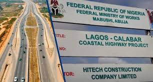
The Coastal road will definitely be redesigned with time. It is clear that the engineers that designed its present form underestimated the volume of water going into the Sea all along that coast apart from the estuary outlets at Bonny Camp and Ẹ̀pẹ́.
The geographical reality is that right from Oworonshoki to Epe southwards, you have a vast delta marking the collapse of small streams and the Ogun River. All these flow into the Lagos Lagoon which is actually a portion of the Atlantic partly surrounded by land. That mighty volume of water is pressing southwards gently, seeping underground and in streams into the Atlantic. What the coastal road has done is to close everything in exactly as a dam would. The road, in real terms is a weak, low dam, running all across the length of the Lagoon right after the Bonny Camp estuary.
Water can be very gentle, but it is always unmistakable in its language. That water is seeking the shores and is interrogating the stranger it found on the way restraining it. The Coastal Road is that stranger. And of course the water has already started asking the road emphatic questions. It is often flooded as water from upland overruns the road after rains and portions have large pools trapped in the median. Those are not friendly hands the water is dealing.




What will be done eventually is that parts of the road will be elevated using big culverts or bridges. The exact specifics will be dictated by the volume of water running through which sector and how much diversion/channelization of water can be done upland around 1 to 5 kilometers from the road into specific sections of the road where you will have those culverts and bridges.

The defence of the Works minister David Umahi is merely political. It is unrealistic. He will definitely come back and do the right thing because water, though boneless and without a shadow, never negotiates. The flat terrain hides the fact that water is pissed and that could go on for quite a while, but the day comes when water’s patience is spent and it will carry everything before it without any further warning. The water body we are talking about is 60km along the coast and approximately 3km deep. Take it as 200sqm and let’s assume its 250mm deep in the average. That’s 45 billion litres of water constantly asking that coastal road questions. It’s hopeless to hope the road will have an answer except to give way in certain areas so the water can pass.
The further implications of this is that the use of all that land inland of the road will need meticulous replanning. There will be a need to provide drainage corridors with allowances for storms. Construction of canals is possible but that should be stretched across about 50 years so that the public works budget doesn’t get overloaded and also so that we can understand the temperament of the water better. The most well-known place where water has been handled at this volume is of course The Netherlands. You can also take a look at New Orleans in the United States. We may wish to learn from those places and also pay attention to the stretch of time it took to understand the water’s seasonality and build the coping systems. If development is allowed to continue in that corridor without adequate planning and patience, we are going wake up one day and find the water irreverently displaying its contempt for our lack of discretion.